
A new story mapping tool brings groundwater information to the surface
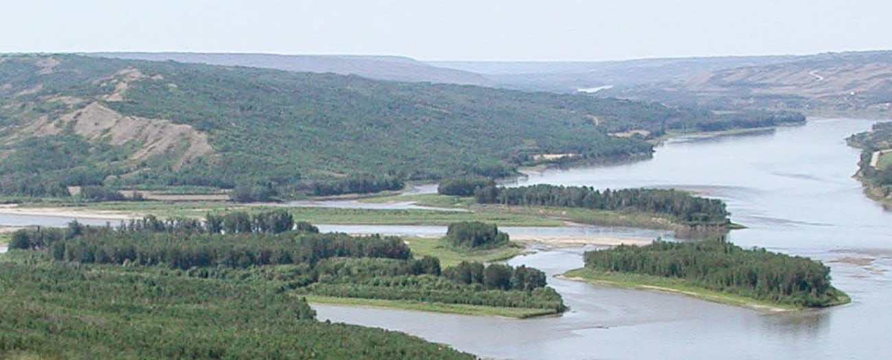
Alberta - November 09, 2021Everything has a story, even groundwater. Like any good narrative, the groundwater story has a setting, Alberta, from the Foothills to the Eastern Plains to the Athabasca Basin, a protagonist, the Alberta Geological Survey (AGS), and it even has a quest, uncovering the mystery of the province's hydrogeological regions. This is that tale …
In April 2021, the AGS released a new and exciting series of story maps identifying and describing the groundwater regions of Alberta. These areas, known as hydrogeological regions, have unique characteristics that influence where groundwater is available. Albertans rely on groundwater for rural drinking supplies, agriculture, and industrial activities, including oil and gas, and mining. Without these maps, we do not have a wholistic picture of groundwater in the province.
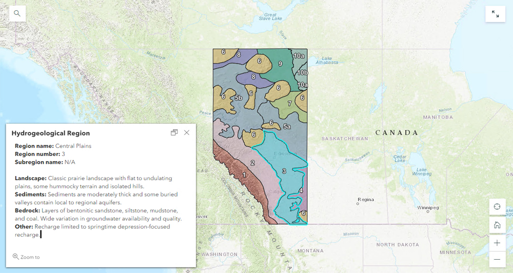
This interactive map gives a brief overview of each hydrogeological region. More in-depth information is provided in dedicated story maps for each region.
Story maps are interactive reports that allow users to view diagrams and pictures in a web format. Part of the AGS's mandate is to provide knowledge and data on the province's geology and to provide resources to the public. Jessica Liggett, a senior hydrogeologist with AGS who helped develop the maps, said this effort perfectly encompasses their mandate as story maps are an innovative way to share complex information.
"We had all the information, but it wasn't in one place; you had to look at a variety of sources and the information was very technical. The story maps are visual to help people digest the information more easily."
- Jessica Liggett, senior hydrogeologist.
Alberta has 10 hydrogeological regions. They differ based on geology, geological history, sediment thickness, climate, and groundwater source. They also differ in groundwater quality, with some geological formations having, for example, high salt content that may make it unusable for drinking, agriculture, or industrial use.
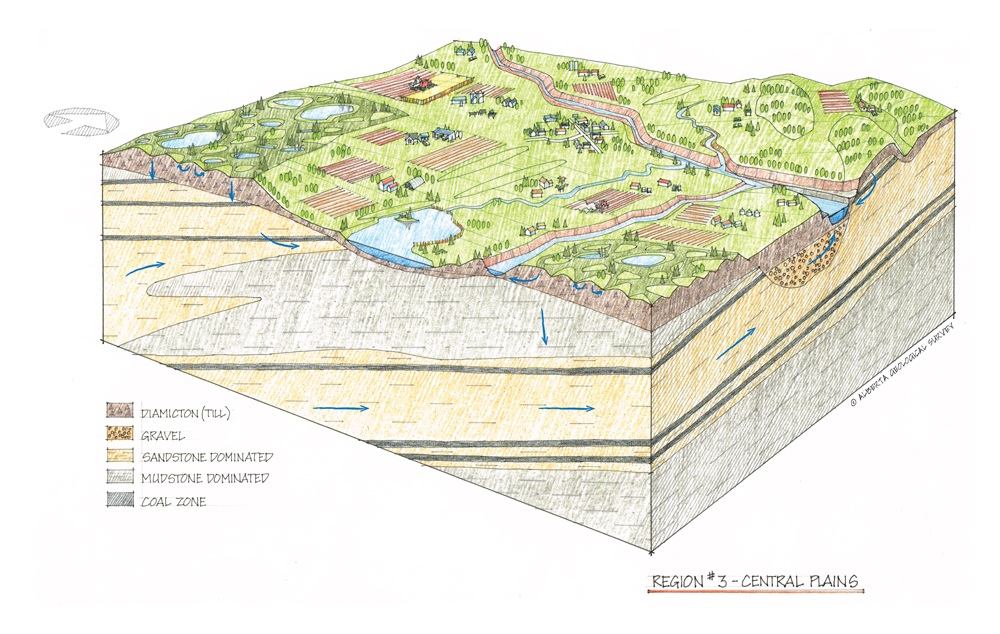
This diagram shows a conceptualization of each region’s unique hydrogeological setting.
Liggett explains that anyone can access these story maps, but it would be of particular interest to those working in water management and planning or watershed protection. "The story maps provide a good overview of the hydrogeology of the province so they're useful to industry, government, non-profit agencies, and university students as it helps them locate groundwater in the province and understand its various characteristics."
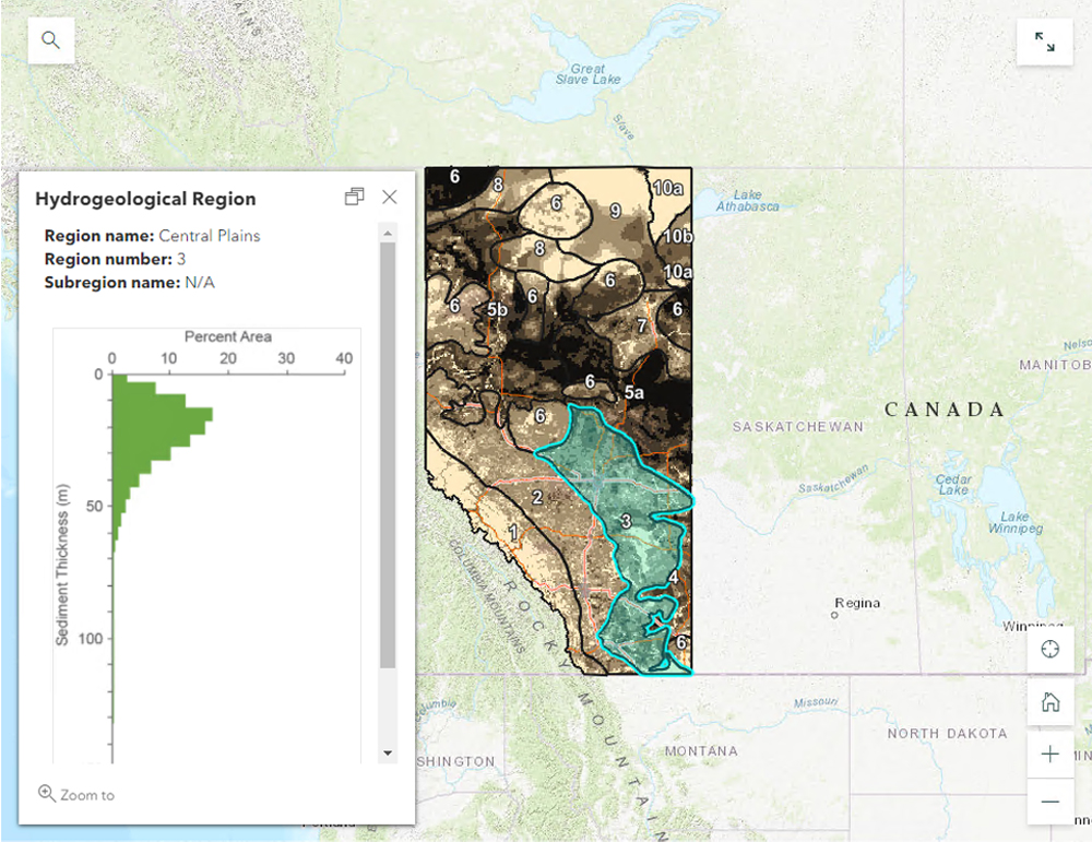
This interactive map shows sediment thickness within each region.
Steve Wallace, director of water quantity and allocation policy at Alberta Environment and Parks, echoed those remarks.
"The hydrogeological regions of Alberta tell a complex story of how geological materials, groundwater flow systems, and climate form an integrated system using a highly interactive tool with clear graphics that many water stakeholders will understand. We are excited to use this product as we further develop groundwater management tools in Alberta."
The tale of Alberta's hydrogeological regions is publicly available on the AGS website as part of their story map collection.
Resource Editor